
Ski Lessons by SkiBro
BOOK NOW
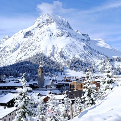
Ski lessons in Verbier
Book now


Verbier Weather (Next 3 days): The snow forecast for Verbier is: A dusting of new snow. Freeze-thaw conditions (max 2°C on Mon morning, min -4°C on Fri night). Wind will be generally light.
Verbier Weather (Days 4-6): Moderate rain (total 11.0mm) heaviest on Mon afternoon, then becoming colder with a dusting of snow on Tue night. Temperatures will be slightly above freezing (max 4°C on Tue afternoon, min 1°C on Tue night). Wind will be generally light.
| Resort | Snow Depth | Temp. (°C) | Wind (km/h) | Weather | ||
|---|---|---|---|---|---|---|
| Top Lift: | 0.0 m | -10 | ||||
| Middle Lift: | -3 | |||||
| Bottom Lift: | 0.0 m | 5 |
Latest snow reports near Verbier:
Light rain reported from Aosta Airport at 546 metres elevation 5 kms NE of Pila but it is forecast cold enough for snow at the ski area from Pila

Fri 26 | Saturday 27 | Sunday 28 | Monday 29 | Tuesday 30 | Wednesday 1 | Thursday 2 | ||||||||||||||
PM | night | AM | PM | night | AM | PM | night | AM | PM | night | AM | PM | night | AM | PM | night | AM | PM | night | |
light snow | snow shwrs | snow shwrs | cloudy | light snow | light snow | light snow | some clouds | some clouds | light rain | light rain | light rain | rain shwrs | light snow | snow shwrs | light rain | light snow | light snow | light snow | mod. snow | |
km/h | ||||||||||||||||||||
Snow map |  |  |  |  |  |  |  | |||||||||||||
1.0 | 1.0 | — | — | — | — | — | — | — | — | — | — | — | — | — | — | — | — | 1.0 | 6 | |
— | — | — | — | — | — | — | — | — | 1.0 | 1.0 | 1.0 | 2.0 | 1.0 | 1.0 | 2.0 | 2.0 | — | — | — | |
max°C | -3 | -3 | -2 | 0 | -1 | 1 | 1 | 1 | 2 | 3 | 2 | 3 | 4 | 3 | 3 | 4 | 3 | 1 | 2 | 1 |
min°C | -3 | -4 | -3 | -1 | -1 | 0 | 1 | 0 | 1 | 3 | 2 | 2 | 4 | 1 | 1 | 3 | 1 | 1 | 2 | -1 |
-7 | -9 | -8 | -6 | -7 | -5 | -4 | -5 | -3 | -1 | -3 | -3 | 0 | -3 | -3 | 0 | 1 | 1 | 2 | -4 | |
86 | 70 | 71 | 70 | 76 | 79 | 84 | 62 | 72 | 78 | 73 | 77 | 77 | 88 | 76 | 79 | 89 | 87 | 96 | 98 | |
2050 | 1550 | 2150 | 2400 | 2200 | 2600 | 2650 | 2550 | 2800 | 2900 | 2850 | 2900 | 2950 | 2750 | 2750 | 2900 | 2650 | 2600 | 2650 | 2350 | |
— | — | 6:22 | — | — | 6:20 | — | — | 6:20 | — | — | 6:18 | — | — | 6:16 | — | — | 6:15 | — | — | |
— | 8:32 | — | — | 8:34 | — | — | 8:35 | — | — | 8:37 | — | — | 8:37 | — | — | 8:38 | — | — | 8:40 | |
A dusting of new snow. Freeze-thaw conditions (max 2°C on Mon morning, min -4°C on Fri night). Wind will be generally light.
Moderate rain (total 11.0mm) heaviest on Mon afternoon, then becoming colder with a dusting of snow on Tue night. Temperatures will be slightly above freezing (max 4°C on Tue afternoon, min 1°C on Tue night). Wind will be generally light.
Latest snow reports near Verbier:
Light rain reported from Aosta Airport at 546 metres elevation 5 kms NE of Pila but it is forecast cold enough for snow at the ski area from Pila
| Top snow depth: | 0 cm |
|---|---|
| Bottom snow depth: | 0 cm |
| Fresh snowfall depth: | 8 cm |
| Last snowfall: | 24 Apr 2024 |
| Snow Alerts | Create Alert |
0.4 | Bluebird Powder days Fresh snow, mostly sunny, light wind. |
|---|---|
1.7 | Powder days Fresh snow, limited sun, any wind. |
0.4 | Bluebird days Average snow, mostly sunny, light wind. |


The above table gives the weather forecast for Verbier at the specific elevation of 2415 m. Our sophisticated weather models allow us to provide snow forecasts for the top, middle and bottom ski stations of Verbier. To access the weather forecasts for the other elevations, use the tab navigation above the table. For a wider view of the weather, check out the Weather Map of Switzerland.
Click here to read further information on freezing levels and how we forecast our temperatures.
Overall 4.1 Based on 90 votes and 97 reviews
Verbier, one of the few places remaining on my bucket list after 37yrs of skiing all over the world. I ticked it off with friends in Jan 23 and it was so good I'm taking my family of 5 there for Christmas! It's pricey for food and drink but we have an apartment this year and the skiing itineraries and off-piste make it stand out as one of the very best. Attelas to Carrefour is also an amazing piste run.
Nigel Hawkins from Jersey writes:
Verbier, one of the few places remaining on my bucket list after 37yrs of skiing all over the world. I ticked it off with friends in Jan 23 and it was so good I'm taking my family of 5 there for Christmas! It's pricey for food and drink but we have an apartment this year and the skiing itineraries and off-piste make it stand out as one of the very best. Attelas to Carrefour is also an amazing piste run.
The Verbier skiing weather widget is available to embed on external websites free of charge. It provides a daily summary of our Verbier snow forecast and current weather conditions. Simply go to the feed configuration page and follow the 3 simple steps to grab the custom html code snippet and paste it into your own site. You can choose the snow forecast elevation (summit, mid-mountain or bottom lift) and metric/imperial units for the snow forecast feed to suit your own website…. Click here to get the code.
View detailed snow forecast for Verbier at:
snow-forecast.com


 Nearest